
As usual, the agenda for the Epping Forest district council meeting last night had a slot for councillors to ask questions to members of the Cabinet. Given the meeting was just 24 hours after the start of the local plan consultation I was surprised how few councillors raised issues.
My fellow Lib Dem councillor Janet Whitehouse asked about comments she’d received from residents who had found it difficult to interpret the maps (below – click to enlarge) published in the local plan and at the public information points. She asked (see video) if road names could be added to the maps to make it easier to identify the site locations.
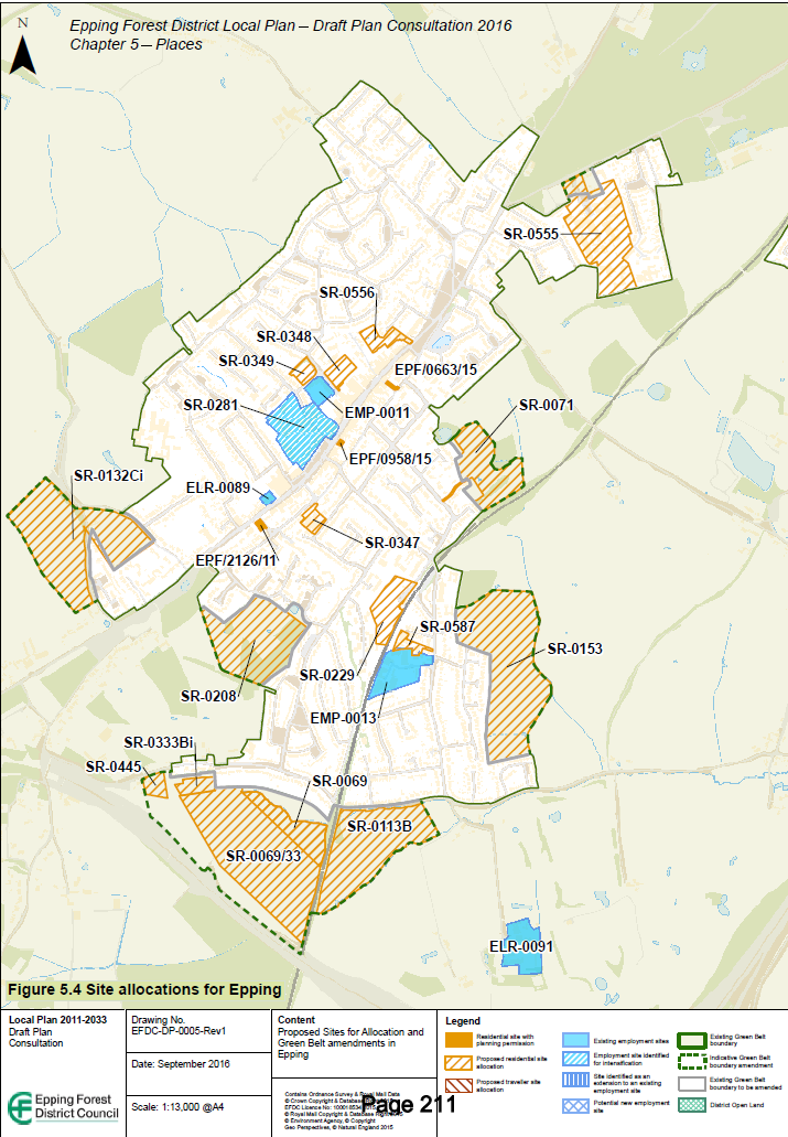
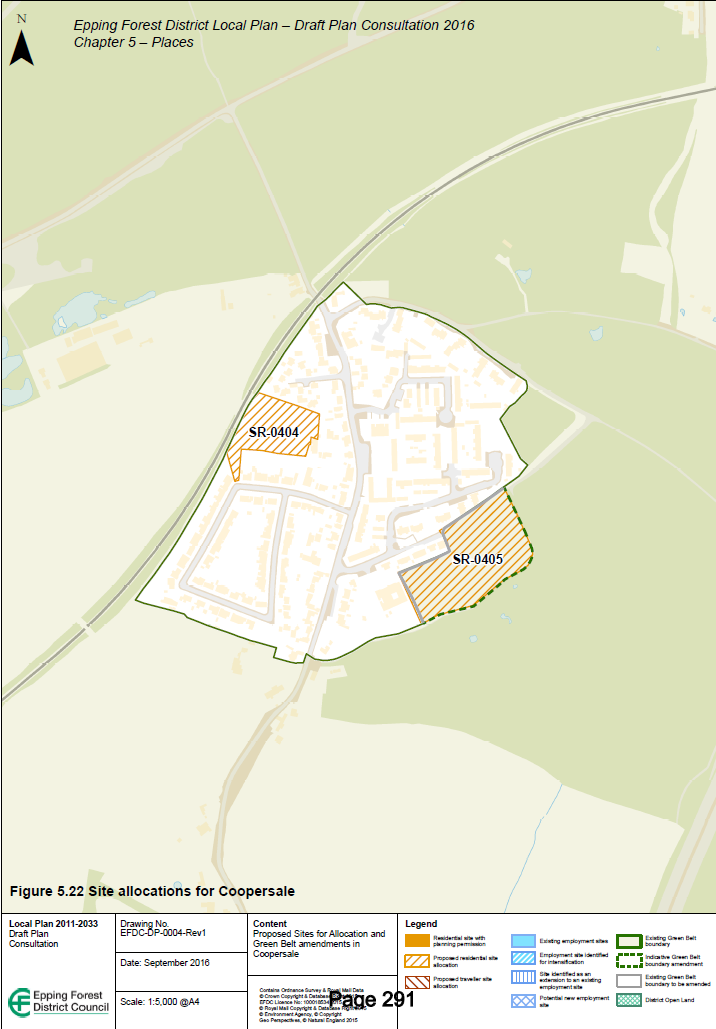
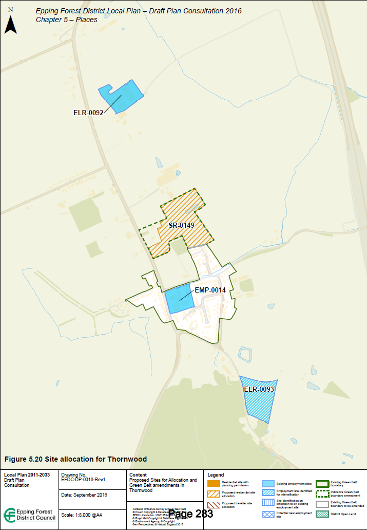
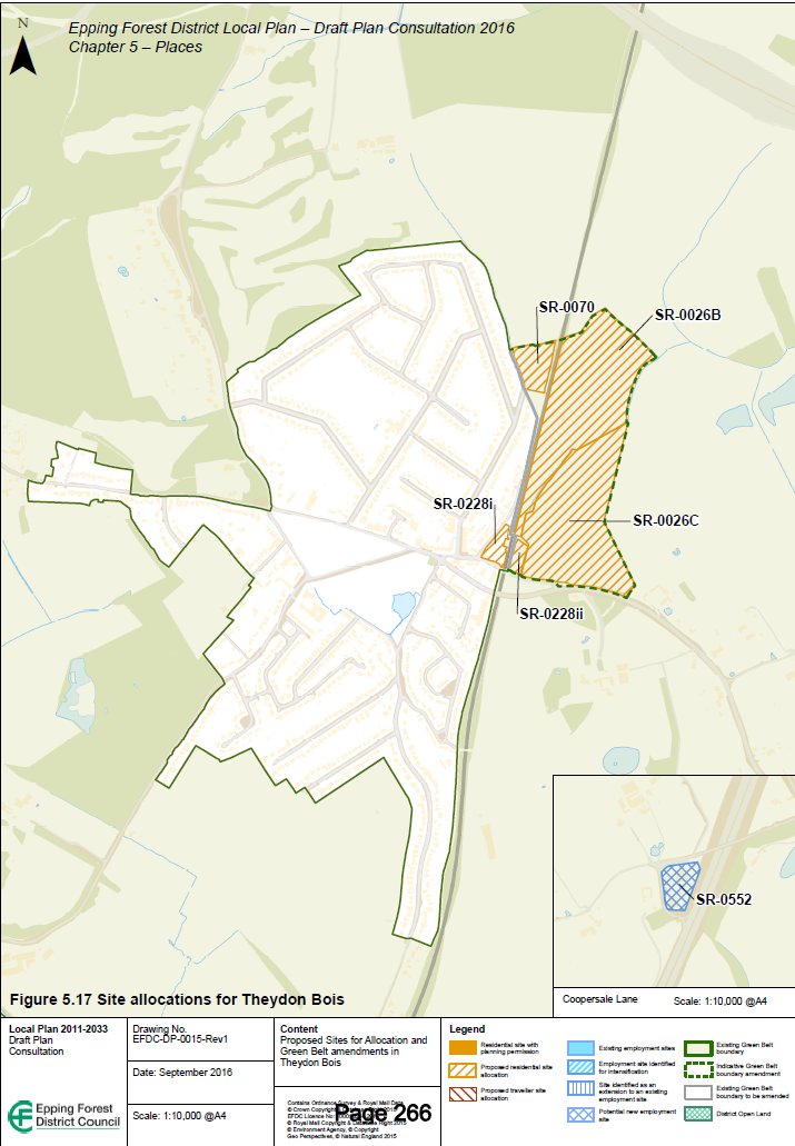
Unfortunately she received the response that the maps had been printed and it would be too difficult for the council to make changes. Residents who want to clarify site locations can:
- Download detailed information showing site boundaries from the council website. These documents also show sites that were considered and then not included in the draft Local Plan. The direct links for the Epping, Theydon Bois, Coopersale and Thornwood sites are below:
- Epping and Coopersale [pdf]
- Theydon Bois [pdf]
- North Weald (including Thornwood) [pdf]Information on sites in other parts of the district is at http://eppingforest.consultationonline.co.uk/technical-information (look for the site selection report appendices).
- Attend an exhibition and talk to a member of staff. The Epping exhibition is in Epping Hall on Friday 11 November from 3.30pm until 8pm. There is an exhibition at North Weald Village Hall this Saturday (5 November) from 10am until 2pm and at Lopping Hall in Loughton on Monday 7 November from 3.30pm until 8pm. Details of the Chigwell and Ongar exhibitions are on the council website.
- Call the council’s Local Plan information line for advice on 01992 564517 or email LDFConsult@eppingforestdc.gov.uk.